


Elon Voting District, Amherst County, Virginia
About
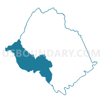
Outline

Summary
| Unique Area Identifier | 681037 |
| Name | Elon Voting District |
| County | Amherst County |
| State | Virginia |
| Area (square miles) | 85.36 |
| Land Area (square miles) | 83.38 |
| Water Area (square miles) | 1.99 |
| % of Land Area | 97.67 |
| % of Water Area | 2.33 |
| Latitude of the Internal Point | 37.54971670 |
| Longtitude of the Internal Point | -79.26312020 |
Maps


Graphs
Select a template below for downloading or customizing gragh for Elon Voting District, Amherst County, Virginia


Neighbors
Neighoring Voting District (by Name) Neighboring Voting District on the Map
- Amelon Voting District, Amherst County, VA
- Big Island Elem School Voting District, Bedford County, VA
- Boonsboro Elem School Voting District, Bedford County, VA
- First Ward Fourth Precinct, Lynchburg city, VA
- First Ward Third Precinct, Lynchburg city, VA
- Maury River Voting District, Rockbridge County, VA
- Monroe Voting District, Amherst County, VA
- Pleasant View Voting District, Amherst County, VA
- Second Ward First Precinct, Lynchburg city, VA
Top 10 Neighboring County Subdivision (by Population) Neighboring County Subdivision on the Map
- Lynchburg city, Lynchburg city, VA (75,568)
- Jefferson district, Bedford County, VA (23,839)
- Peaks district, Bedford County, VA (7,116)
- District 4, Amherst County, VA (6,660)
- District 3, Amherst County, VA (6,591)
- Buffalo district, Rockbridge County, VA (4,369)
- Natural Bridge district, Rockbridge County, VA (3,042)
Top 10 Neighboring Place (by Population) Neighboring Place on the Map
Top 10 Neighboring Unified School District (by Population) Neighboring Unified School District on the Map
- Lynchburg City Public Schools, VA (75,568)
- Bedford County Public Schools, VA (68,676)
- Amherst County Public Schools, VA (32,353)
- Rockbridge County Public Schools, VA (22,307)
Top 10 Neighboring State Legislative District Lower Chamber (by Population) Neighboring State Legislative District Lower Chamber on the Map
- State House District 23, VA (80,898)
- State House District 19, VA (78,345)
- State House District 24, VA (72,372)
Top 10 Neighboring State Legislative District Upper Chamber (by Population) Neighboring State Legislative District Upper Chamber on the Map
Top 10 Neighboring 111th Congressional District (by Population) Neighboring 111th Congressional District on the Map
Top 10 Neighboring Census Tract (by Population) Neighboring Census Tract on the Map
- Census Tract 301.01, Bedford County, VA (6,639)
- Census Tract 101, Amherst County, VA (5,288)
- Census Tract 1, Lynchburg city, VA (4,490)
- Census Tract 9304, Rockbridge County, VA (3,945)
- Census Tract 303, Bedford County, VA (3,739)
- Census Tract 103, Amherst County, VA (3,477)
- Census Tract 104.01, Amherst County, VA (3,375)
- Census Tract 4, Lynchburg city, VA (3,099)
- Census Tract 104.02, Amherst County, VA (3,033)
- Census Tract 105.03, Amherst County, VA (2,323)
Top 10 Neighboring 5-Digit ZIP Code Tabulation Area (by Population) Neighboring 5-Digit ZIP Code Tabulation Area on the Map
- 24503, VA (19,331)
- 24572, VA (16,395)
- 24416, VA (8,807)
- 24574, VA (3,977)
- 24555, VA (2,140)
- 24526, VA (1,593)
- 24536, VA (194)